Routes

Valchiavenna
Trekking

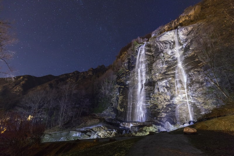
Panoramic Loop of the Acqua Fraggia Waterfalls – Savogno

DIFFICULTY: E
DISTANCE/LENGTH: 3.9 km
ELEVATION GAIN: 500 m
DURATION: 2 hours 30 minutes
BEST PERIOD: From March to November
RECOMMENDED STARTING POINT: Piuro, Borgonuovo
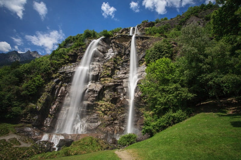
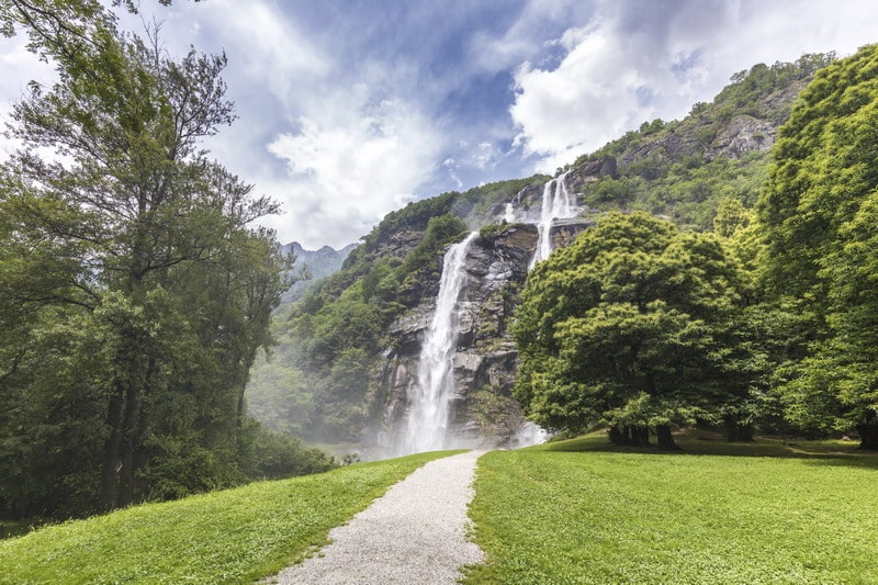
The route starts at the base of the impressive waterfalls, where, among the meadows on their right, a path crosses a small stream. From here, on the left, you reach the last houses of the Sarlone district; still on the left, along the trail through dense woods, you quickly ascend to the first waterfall drop, easily accessible thanks to staircases covering some sections. At the second waterfall drop, it is possible to admire the landscape in all its magnificence from dedicated panoramic viewpoints. Continuing up to the second fork, from where, on the left, a rope bridge leads to the opposite side of the stream, then take the right at a second fork. After crossing another bridge and returning to the original slope, the path rejoins the cobbled trail that leads to Savogno (932 m above sea level).
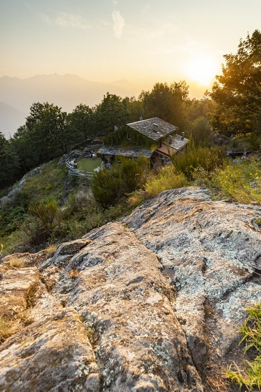
An extraordinary panorama opens up from the churchyard, from which you can venture into exploring the village, rich in scenic views and charming details. The descent, which initially follows the same route as the ascent, continues along the main cobbled path, first passing the Crotti of Savogno and then the Stalle dei Ronchi, finally returning to Sarlone, the starting point.
Routes

Bormio
Trekking

At the foot of the Réit to admire Bormio from above

DIFFICULTY: T
DISTANCE/LENGTH: 10.6 km
ELEVATION GAIN: 450 m
DURATION: 3 hours 30 minutes
BEST PERIOD: From spring to autumn
RECOMMENDED STARTING POINT: Bormio, Combo Bridge

This easy route allows you to admire the enchanting panorama of the Bormio basin from above. The starting point is the historic Combo Bridge, which, once crossed, leads left to the small church of Madonna del Sassello, from where you take the trail on the right towards Valfurva.
At Uzza, cross the bridge that takes the cycle path to the opposite side of the Frodolfo stream, following it until the church of St. Nicolò. Just opposite the churchyard, after crossing the provincial road, an uphill road leads to the upper part of the Teregua district, where you take the trail ascending the Uzza valley.
After two hairpin bends, the first to the right and the second to the left, continue straight until the path crosses the stream. Shortly after leaving the valley, the panoramic route begins, running along the heights above the town of Bormio, among larch forests and dwarf pines. Signs to the locality Pravasivo guide you to Planon dei Laresc and then to the Campello valley, the stream flowing from the slopes of the Réit. Without crossing it, the path descending towards Bormio marks the end of the hike.

Routes

Valchiavenna
Trekking

Loop trail in the Marmitte dei Giganti Nature Reserve

DIFFICULTY: T
DISTANCE/LENGTH: 3.9 km
ELEVATION GAIN: 180 m
DURATION: 1 hour 45 minutes
BEST TIME TO VISIT: All year round
RECOMMENDED STARTING POINT: Chiavenna, Piazza Castello

Designated as the ideal starting point, Piazza Castello in Chiavenna marks the beginning of the trail. From here, take Via Maurizio Quadrio and, just before reaching the bridge over the Mera River, turn right onto Via Poiatengo. This scenic route winds between the river, woods, and cliffs, leading to Prosto di Piuro. Highlights of this charming village include the many traditional “crotti” (natural cellars), the Church of the Assumption, and a local workshop specializing in the crafting of soapstone.
From the church square, a steep stepped path to the left of the church leads into beautiful woods, where you’ll find the first signs of the ancient soapstone quarrying activity—open-air quarries that are among the oldest in the area. Higher up, the glacially smoothed rocks feature fascinating prehistoric engravings.
Once you reach Passo Capiola (489 m a.s.l.), you have two options for the descent to Chiavenna:
The left path is easier, passing through a small valley with lovely clearings.
The right path ascends to Sasso Dragone (520 m a.s.l.), offering a closer view of the glacial erosion formations that give the nature reserve its name.
Detailed descriptions of the main points of interest are provided on the many interpretive panels along the route.

Routes

Valtellina
Trekking

Cólmen of Dazio: a mediterranean oasis in the heart of the Alps

DIFFICULTY: E
DISTANCE/LENGTH: 5.7 km
ELEVATION GAIN: 390 m
DURATION: 2 hours 30 minutes
BEST TIME TO VISIT: All year round
RECOMMENDED STARTING POINT: Dazio, Cemetery

From the parking area near the cemetery in Dazio (557 m a.s.l.), take the dirt road on the left that leads through wide meadows toward La Cólmen (trail markers red and white, no. 5). The route climbs steadily through the woods, passing through the area known as Crotto on its way to the summit.
Before reaching the top, near some rocky outcrops by a curve in the trail, you’ll be treated to a superb view over the central Valtellina, stretching as far as Sondrio and beyond. At the summit (921 m a.s.l.), sun-dappled clearings among shady groves offer a perfect spot to rest. The panoramic views continue at the La Casermetta refuge, located right on the peak and named after a former military lookout post built during World War I.
For the return, follow the mountain ridge westward (trail no. 8), where you’ll pass several small seasonal ponds—essential watering spots for the many deer inhabiting the protected Cólmen area. From the locality of Böcc, marked by the excavation tunnels of ancient iron mines, take trail no. 6 down the northern slope of the mountain back to the village.

Routes

Valtellina
Trekking

Along the ridge between Alpe Granda and San Cères

DIFFICULTY: E
DISTANCE/LENGTH: 9.7 km
ELEVATION GAIN: 850 m
DURATION: 3 hours
BEST TIME TO VISIT: From May to October, and in winter with snow
RECOMMENDED STARTING POINT: Dazio, Cemetery

Between the two mountain pastures of Our di Fondo and Our di Cima, a dirt road begins that, in about an hour, leads to the scenic grassy balcony of Alpe Granda. Leaving the small hill of Cima di Granda on the left, turn right and climb the pasture to reach the new Alpe Granda refuge (1,688 m a.s.l.).
A trail enters the forest, passing through Alpe Merla and then, after two switchbacks, reaches the central section of the broad Scermendone pasture. This lies along the ridge separating Valtellina from the eastern side of Valmasino. From here, enjoy a spectacular panorama: to the south, the Orobic Alps and much of Valtellina; to the north, the towering peaks of Valmasino; to the east, Monte Disgrazia; and to the west, the mountains of the Costiera dei Cèch.
After passing a small lake near a mountain hut, continue along the ridge to the final destination: the ancient church of San Quirico, locally known as San Cères (2,131 m a.s.l.).
The return route follows the same trail.

Routes

Valtellina
Trekking

Lake Palù: a sapphire jewel in the heart of Valmalenco

DIFFICULTY: E
DISTANCE/LENGTH: 8.5 km
ELEVATION GAIN: 440 m
DURATION: 3 hours
BEST TIME TO VISIT: From May to October, and in winter with snow
RECOMMENDED STARTING POINT: Chiesa Valmalenco, San Giuseppe

Near the parking area by the San Giuseppe chairlift, take the dirt road that begins at the bridge. After a few switchbacks through conifer forests, you’ll reach the locality of Barchi, where the path turns into a trail, briefly running alongside what becomes a ski slope in winter.
Turning left, you leave the wide slope and zigzag through the forest. As the slope gradually lessens, you’ll arrive at your destination. Suddenly, the lake appears (1,921 m a.s.l.), rewarding all effort with its stunning beauty—perfect for a refreshing swim in the warmer months.
Don’t miss the unmatched views from the Palù refuge, on the left-hand side of the lake as you approach. A half-hour walk along the lake’s edge offers breathtaking vistas.
For the return, you can retrace the same route or take an alternate trail that begins to the right, just below the refuge. It winds through the woods and the localities of La Zocca, Il Barchetto, and Paluetto. Continuing left from this scenic meadow basin, you’ll soon reconnect with the original path.

Routes

Valtellina
Trekking

Alpe Prabello and the Campagneda Alpine Lakes

DIFFICULTY: E
DISTANCE/LENGTH: 10.1 km
ELEVATION GAIN: 430 m
DURATION: 3 hours
BEST TIME TO VISIT: From May to October, and in winter with snow
RECOMMENDED STARTING POINT: Lanzada, Campo Moro

From the large parking area at Campo Moro, near the Zoia refuge (2,021 m a.s.l.), take the trail next to the refuge that skirts the southern side of Mount Spundascia. This mountain overlooks both the artificial lake on one side and the wide Campagneda valley on the other.
Passing rock faces polished by glaciers—now equipped for climbing—you’ll soon reach Alpe Campagneda. From here, following the signs and crossing a small stream in the valley bottom, it takes just over half an hour to arrive at the enchanting Alpe Prabello (2,226 m a.s.l.), nestled beneath the majestic peak of Pizzo Scalino.
The return follows the same route; however, more energetic hikers can take a circular route by continuing up to the Campagneda alpine lakes (the first at 2,279 m a.s.l.) and descending via the main valley to rejoin the original trail near the Alpe Campagneda refuges.
The route is also recommended for mountain bikers, who can start from the parking area located just over a kilometer before Campo Moro, at the beginning of the dirt road.

Routes

Teglio
Trekking

Through the hills of Teglio among the fields and vineyards of Valgella

DIFFICULTY: E
DISTANCE/LENGTH: 9.8 km
ELEVATION GAIN: 320 m
DURATION: 3 hours
BEST TIME TO VISIT: From spring to autumn
RECOMMENDED STARTING POINT: Teglio, Piazza S. Eufemia

The first stop is the tower of Teglio Castle (893 m a.s.l.), offering a stunning panoramic view of much of the Valtellina valley. From the hill, descend toward Palazzo Besta until the road on the left becomes a trail, leading to the Church of St. Anthony and then to the hamlet of Vangione (trail marker no. 306).
Continuing in the same direction, pass through the hamlet and reach the locality of La Sella (620 m a.s.l.), a wine-growing area known for Valgella. Skirting a gentle hill almost entirely to the right, a small bridge crosses a stream—this marks the beginning of the ascent back.
At the Church of St. John, turn right and follow signs for Teglio. You’ll pass through the locality of Capitel and then climb the panoramic ridge of Dos de la Forca, where prehistoric cup-marks are still visible on the rocks.
After crossing the long ridge, descend toward Teglio through wide meadows and fields often cultivated with buckwheat. Once on the paved road, follow it right for about a hundred meters, then turn left onto a farm track through the fields, which leads back to Teglio.

Routes

Grosio
Trekking

Grosio and Grosotto: a journey back over 5,000 years

DIFFICULTY: T
DISTANCE/LENGTH: 6.6 km
ELEVATION GAIN: 120 m
DURATION: 2 hours
BEST TIME TO VISIT: From March to November
RECOMMENDED STARTING POINT: Grosio, southern parking area of the Rock Engravings Park

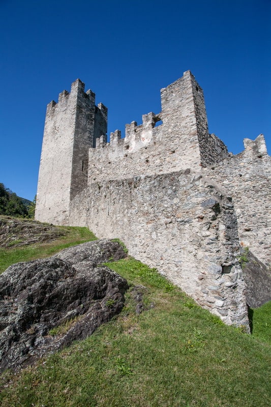
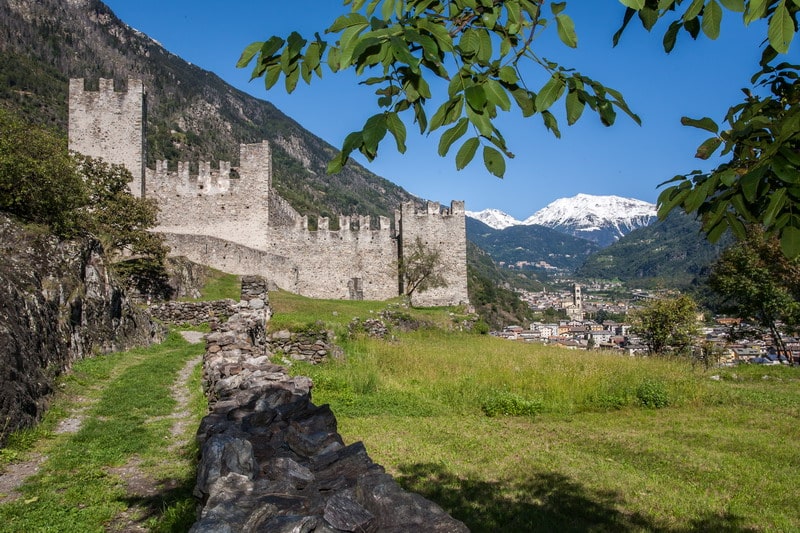
From the southern parking lot below the Castle Rock, trail no. 205 leads through the last vineyards of the Valtellina to the medieval ruins. From the Castello Nuovo, enjoy a striking view of the Rupe Magna, the largest engraved rock in Europe, and the impressive hydroelectric facilities of the Grosio power station.
After exploring the castles and prehistoric rock carvings, the trail continues down into the village. First, you’ll come across the majestic parish church of St. Joseph, then, across the road, Villa Visconti Venosta, and behind it, through narrow alleyways, the Church of St. George.
To the left of the church, follow Via Pruneri toward the river, then turn right onto the Sentiero Valtellina. You’ll pass the elegant Grosotto hydroelectric plant, before reaching a serene fishing pond—ideal for a relaxing break.
Continue on Via Molini to enter the village, passing the square to the left of the Town Hall, then turn right onto Via Patrioti, rich in historical charm. At the end lies the Sanctuary of the Blessed Virgin of Grosotto, a true baroque masterpiece. Continuing along the road, you’ll soon return to the starting point.

Routes

Trela
Trekking

Trela pass loop: solitude and breathtaking views

DIFFICULTY: E
DISTANCE/LENGTH: 13.8 km
ELEVATION GAIN: 700 m
DURATION: 4 ½ hours for the full loop, 3 ½ hours for the shorter route
BEST TIME TO VISIT: From spring to autumn
RECOMMENDED STARTING POINT: Valdidentro, Lake S. Giacomo

This deeply rewarding hike begins just past the S. Giacomo rest stop, where a dirt road branches off to the left into the wild Val Pettini. Following the signs to the Trela alpine huts, you’ll reach a stunning intersection of four lush valleys—an area known for its fine alpine cheeses.
Take the trail to the left leading to Bocche di Trela (2348 m a.s.l.), where the landscape opens up to reveal sweeping views all the way to Valfurva. After descending toward Case Vezzola, a fork offers the chance to turn right and climb again into Val Vezzola.
Roughly two kilometers along trail no. 176, a plateau on the right leads to Bocchetta Trelina. After the descent, you’ll return to the Trela huts.
At this point, tired hikers can retrace the morning’s path back to the starting point. Those wanting to extend the experience can turn left into Val Trela, climbing until they find, on the right, a trail to the Bocchetta di Valle Lunga (2335 m a.s.l.). The descent from this point through the Valle Lunga soon reconnects with the Val Pettini road, closing the loop.